


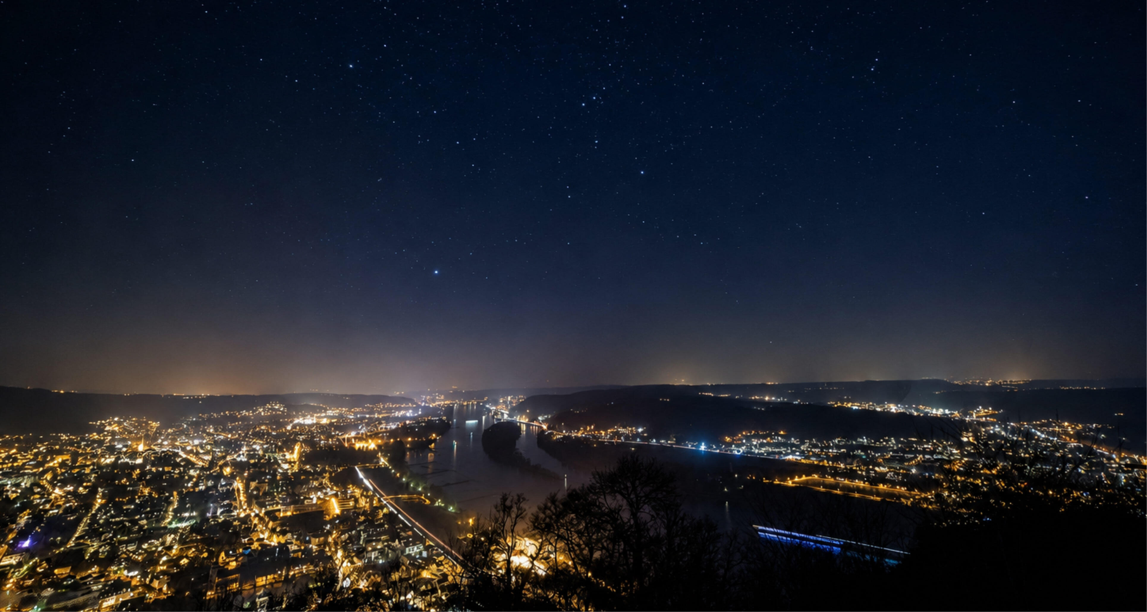
You can be 30 miles from the nearest stoplight and still have a bright horizon. That’s what the new Light Pollution layer in Land id shows you.
It's built from NASA/NOAA satellite imagery measuring how much artificial light is visible from space each night, and what makes it useful for Land is that it doesn't just read brightness at a single point. It accounts for the surrounding glow from nearby towns and cities, the diffuse skyglow that washes out stars even when you're standing well outside city limits.
Once you start moving around the map, the same data answers at least four completely different questions depending on what you're looking for. Some people are hunting for dark. Some are hunting for the opposite. Same layer, opposite conclusions, both useful.
That’s exactly why it belongs in the overlay stack. Soils and hydrology tell you what the ground does. Light tells you what's coming toward it, and how far you are from everything. Anyone doing land diligence without night data is working with half a picture.
How Dark Is It, Really?
This is the obvious question, and it's the one that matters most to buyers chasing a lifestyle.
Dark sky access is one of the hardest amenities to communicate in a listing. There's no MLS field for it. You can't photograph it. A buyer standing on the property at 2pm has no way to know whether they'll see the Milky Way or a glow on the horizon from a town 20 miles east. Ask them to trust a description and you're asking a lot.
Now you can show them. Pull up the parcel, turn on the layer, and the answer is right there in context with everything around it. For land and ranch brokers working remote mountain ground, ranches, hunting property, and retreat parcels, that's something to put on a listing that may not have many comps to work from. It's also a reason to call a buyer who's four hours away and hasn't committed to the drive yet.
For landowners, it's a planning tool. Where do you put the observation deck? Which ridge stays dark if the neighbor develops? Which corner of the property has the cleanest view to the south?
Where Is Growth Coming From?
Instead of looking for dark, look at where it's bright and how the brightness is shaped.
Zoom in on any metro until you can see the suburbs and the small towns around it, and the pattern is unmistakable. Light follows highways. It pools around bedroom communities. It fans out from commercial corridors in a way that traces the actual direction of expansion far more clearly than a jurisdiction boundary ever will.
For investors and buyers doing go or no-go assessments, that's an important signal. A dark parcel on the leading edge of a brightening corridor is a very different asset than an identically dark parcel 90 miles into nowhere. The first one probably has utilities and a road coming. The second one has darkness that will still be there in 30 years. Buy the first one for what's coming. Buy the second one for what isn't.
What's That Glow in the Middle of Nowhere?
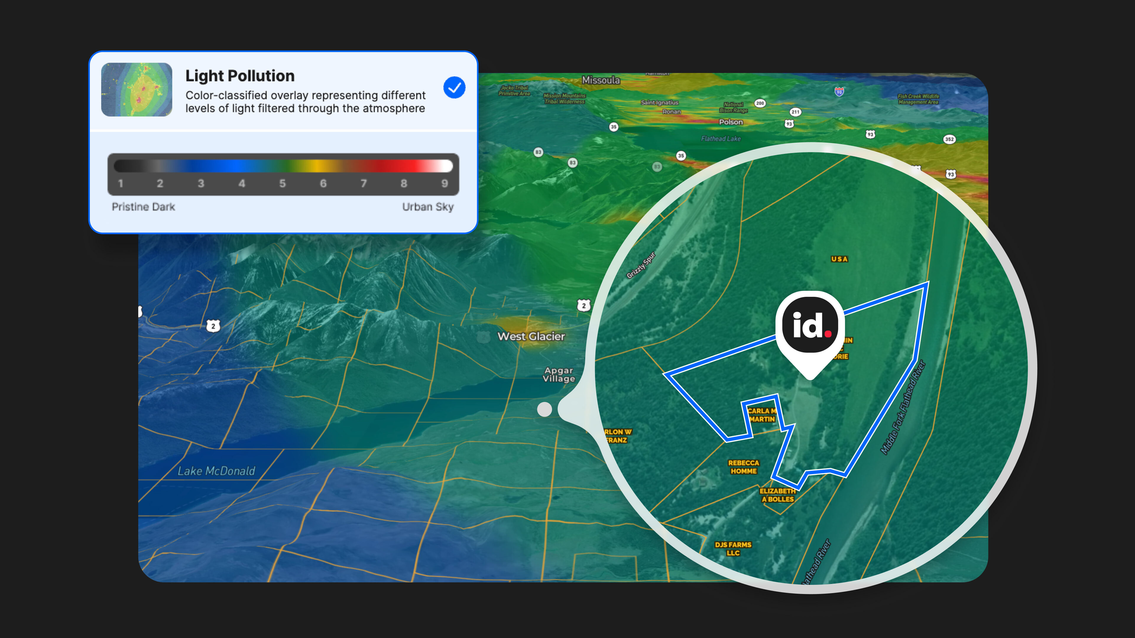
This question will keep you on the map longer than you planned.
Zoom into a rural region and you'll find isolated bright spots sitting in deep darkness with no highway anywhere near them. They're almost never towns. They're quarries, correctional facilities, oil and gas operations, processing plants, and industrial sites running lights all night.
For developers and energy teams, those anomalies are information. Light means power, and power means existing infrastructure and active operations. Find one, then go pull the county permit record and see who's operating out there.
For a buyer evaluating a recreational or residential parcel, that same glow four miles over the ridge is something you'd rather know about before closing than after the first night on the property.
Nothing else in a standard due diligence stack surfaces this quite so quickly.
What Does the Transition Actually Look Like?
Zoom out to a state or regional view and the overlay stops being about individual parcels. It becomes a map of how settled a region is.
A view of Great Falls, Lewistown, and Billings shows the urban-to-rural gradient in one frame. A view of Atlanta and Birmingham shows how urban, suburban, and exurban bleed into each other. Then there's Alaska, where the settlements are so far apart that the darkness is the subject and the towns are the interruption.
If you're prospecting a region rather than a parcel, start here. An hour at this zoom level will save you a week of narrowing down at parcel level.
Try It Tonight
The overlay is live in Land id across all 50 states, including Hawaii and Alaska, and it renders at every zoom level. We acquired the raw data, processed it, and built the zones ourselves, which is why the scale is weighted toward the dark end instead of following an off-the-shelf atlas. A genuinely pristine sky and a merely "pretty dark" one look different here instead of collapsing into a single color.
Open a property you know well and turn on the layer. Then go look at the one you've been dreaming about.
FAQs
Continue Reading
Craig Rowe
Real Estate’s Super El Niño Problem


By Land id
Just some rain...or real estate catastrophe? With months before winter hits, some states are already feeling the effects of this year's so-called Super El Niño. Here's how agents can help their clients.

Craig Rowe
How to Work With Out-Of-State Buyers: Tips for Real Estate Agents
By Land id
Agents in emerging markets will benefit from an influx of aspiring buyers. Get tips on how to make the most of these potentially lucrative leads.

Explore Private Parcel Data & Property Boundaries
Download the Land id app and try for free.


